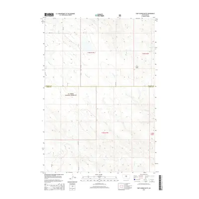
2015 Map of Fort George Butte
USGS Topo · Published 2015About this map
The Ft Pierre National Grassland dominates the central and southern portions of this landscape, reflecting the conserved prairie character of central South Dakota. The topography is defined by the prominent Ft George Butte in the northeast, which overlooks a complex network of seasonal drainage systems. These waterways, including Fort George Cr, Plum Cr, and Cedar Cr, carve a series of draws and valleys across the terrain.
Find a feature on this map
20 named features on this map. Tap any name to fly to it.
Don’t see what you’re looking for? This feature index may not catch every label — zoom into the map to look around manually.
Map Details
Editions of this 2015 Fort George Butte Map
This is the sole edition of this map. No revisions or reprints were ever made.
Other maps of this area

1934 · Canning
USGS Topo · 1:48,000

1937 · Canning
USGS Topo · 1:62,500

1953 · Huron
USGS Topo · 1:250,000

1954 · Pierre
USGS Topo · 1:250,000

1954 · Huron
USGS Topo · 1:250,000

1958 · Pierre
USGS Topo · 1:250,000

1966 · Ft. George Butte SE
USGS Topo · 1:24,000

1966 · Joe Creek NW
USGS Topo · 1:24,000
1966 · Joe Creek SW
USGS Topo · 1:24,000

1967 · Ft. George Butte NW
USGS Topo · 1:24,000