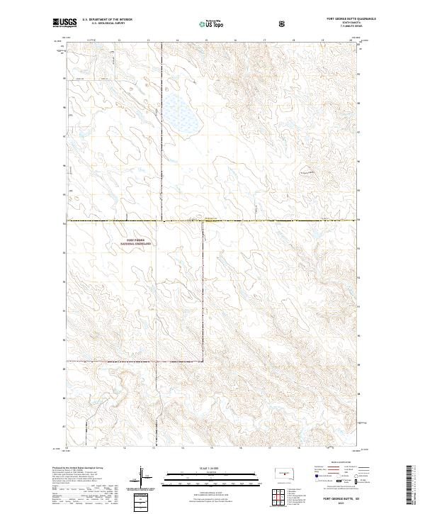
2021 Map of Fort George Butte
USGS Topo · Published 2021About this map
Fort Pierre National Grassland dominates the southwestern portion of this prairie landscape, where the administrative boundary between Stanley and Lyman counties follows the path of Co Hwy 21. The terrain is defined by an intricate network of drainage systems, including the headwaters of La Roche Cr and Straight Cr, which carve through the high plains toward the Missouri River valley. The most prominent landmark is Ft George Butte, a high point in the northeast that served as a natural navigational marker in the vast grassland. Ranching life is suggested by the presence of Dipping Tank Cr and a grid of section-line roads such as 304th Ave and 218th St. This area preserves a largely undeveloped view of the South Dakota plains, where seasonal waterways like Plum Cr and Cedar Cr dictate the layout of local travel and land use.
Find a feature on this map
21 named features on this map. Tap any name to fly to it.
Don’t see what you’re looking for? This feature index may not catch every label — zoom into the map to look around manually.
Map Details
Editions of this 2021 Fort George Butte Map
This is the sole edition of this map. No revisions or reprints were ever made.
Other maps of this area

1934 · Canning
USGS Topo · 1:48,000

1937 · Canning
USGS Topo · 1:62,500

1953 · Huron
USGS Topo · 1:250,000

1954 · Pierre
USGS Topo · 1:250,000

1954 · Huron
USGS Topo · 1:250,000

1958 · Pierre
USGS Topo · 1:250,000

1966 · Ft. George Butte SE
USGS Topo · 1:24,000

1966 · Joe Creek NW
USGS Topo · 1:24,000
1966 · Joe Creek SW
USGS Topo · 1:24,000

1967 · Ft. George Butte NW
USGS Topo · 1:24,000