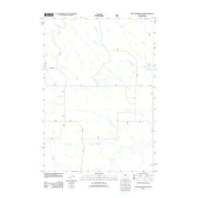
2012 Map of Fort George Butte NW
USGS Topo · Published 2012About this map
Antelope Cr and Timber Cr define the northern drainage of this Lyman County landscape, which is largely characterized by the expansive grazing lands and section-line roads of central South Dakota. The topography is shaped by intermittent watercourses like Cedar Cr and the S Br Cedar Cr, which provide essential water management for the region’s agricultural operations. A notable man-made feature is the Williams 783 Reservoir in the northeast, illustrating the reliance on local water storage in this semi-arid environment. Infrastructure is sparse, consisting of rural routes such as Warcreek Rd and 221st St, along with the north-south corridor of Co Hwy 22. This survey reflects a period of modern ranching and land management where the grid of the Public Land Survey System continues to dictate the local transit and property patterns.
Find a feature on this map
19 named features on this map. Tap any name to fly to it.
Don’t see what you’re looking for? This feature index may not catch every label — zoom into the map to look around manually.
Map Details
Editions of this 2012 Fort George Butte NW Map
This is the sole edition of this map. No revisions or reprints were ever made.
Other maps of this area

1924 · Pierre
USGS Topo · 1:62,500

1934 · Canning
USGS Topo · 1:48,000

1937 · Canning
USGS Topo · 1:62,500

1954 · Pierre
USGS Topo · 1:250,000

1958 · Pierre
USGS Topo · 1:250,000

1966 · Ft. George Butte SE
USGS Topo · 1:24,000

1967 · Ft. George Butte NW
USGS Topo · 1:24,000

1967 · Ft. George Butte SW
USGS Topo · 1:24,000
1967 · Ft. George Butte
USGS Topo · 1:24,000

1972 · Pierre 3 SE
USGS Topo · 1:24,000