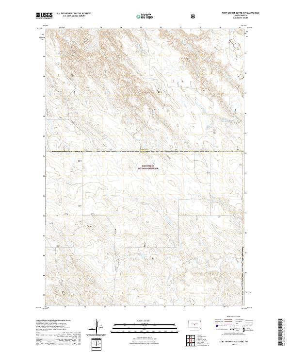
2021 Map of Fort George Butte NW
USGS Topo · Published 2021About this map
The Fort Pierre National Grassland dominates the southern half of this South Dakota landscape, illustrating the vast open grazing lands preserved between the Missouri River and the state's western plains. This 2021 survey reveals a territory primarily defined by its drainage systems and the section-line grid of the Public Land Survey System. High-country drainage is captured by Antelope Cr and Timber Cr in the north, while the southern reaches are fed by Cedar Cr and the S Br Cedar Cr. The human footprint is sparse, consisting mainly of gravel section roads like Warcreek Rd and 302nd Ave. The presence of the Williams 83 Reservoir highlights the critical role of water management in this arid ranching environment, where livestock and wildlife rely on scattered tanks and small impoundments across the grassland.
Find a feature on this map
15 named features on this map. Tap any name to fly to it.
Don’t see what you’re looking for? This feature index may not catch every label — zoom into the map to look around manually.
Map Details
Editions of this 2021 Fort George Butte NW Map
This is the sole edition of this map. No revisions or reprints were ever made.
Other maps of this area

1924 · Pierre
USGS Topo · 1:62,500

1934 · Canning
USGS Topo · 1:48,000

1937 · Canning
USGS Topo · 1:62,500

1954 · Pierre
USGS Topo · 1:250,000

1958 · Pierre
USGS Topo · 1:250,000

1966 · Ft. George Butte SE
USGS Topo · 1:24,000

1967 · Ft. George Butte NW
USGS Topo · 1:24,000

1967 · Ft. George Butte SW
USGS Topo · 1:24,000
1967 · Ft. George Butte
USGS Topo · 1:24,000

1972 · Pierre 3 SE
USGS Topo · 1:24,000