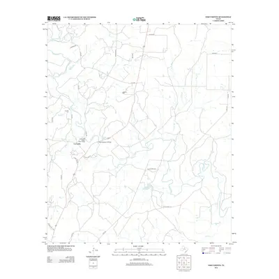
2012 Map of Fort Griffin
USGS Topo · Published 2012About this map
Fort Griffin occupies a strategic position along the meandering Clear Fork of the Brazos River, serving as the focal point for this landscape in Shackelford County. The terrain is defined by a dense network of tributaries including Mill Cr, Shirley Br, and Foyle Cr, which cut through the ranchlands. Local history is anchored by the Ft Griffin Cem and Ledbetter Cem, providing valuable touchpoints for genealogical research. Infrastructure here reflects both modern transit and historical routes, notably the State Highway 23 Bridge and the Fort Griffin Brazos River Bridge. Small bodies of water like Taylor Lake and McGowan Lake dot the landscape, while named thoroughfares such as Old Albany Rd and Nichols Rd trace the path of earlier frontier movement across this Central Texas region.
Find a feature on this map
34 named features on this map. Tap any name to fly to it.
Don’t see what you’re looking for? This feature index may not catch every label — zoom into the map to look around manually.
Map Details
Editions of this 2012 Fort Griffin Map
This is the sole edition of this map. No revisions or reprints were ever made.
Other maps of this area

1892 · Albany
USGS Topo · 1:125,000

1893 · Albany
USGS Topo · 1:125,000

1954 · Abilene
USGS Topo · 1:250,000

1954 · Wichita Falls
USGS Topo · 1:250,000

1958 · Wichita Falls
USGS Topo · 1:250,000

1958 · Abilene
USGS Topo · 1:250,000

1958 · Edwards Branch
USGS Topo · 1:24,000

1965 · Collins Creek
USGS Topo · 1:24,000

1965 · Lusk
USGS Topo · 1:24,000

1965 · Fort Griffin
USGS Topo · 1:24,000