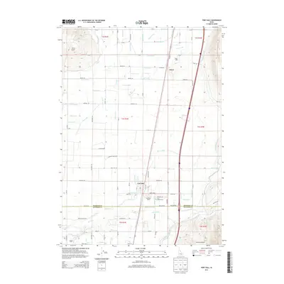
2013 Map of Fort Hall
USGS Topo · Published 2013About this map
Fort Hall and Gibson anchor this portion of the Snake River Plain, dominated by a intricate network of irrigation channels. The map documents the vital infrastructure of the Fort Hall Indian Agency, where the desert landscape is transformed by an expansive system of laterals and canals including the Gibson Canal, Nadine Lateral, and Townsend Lateral. This managed water system supports the agricultural activities of the region, which transitions from the flatlands into the rising elevations of the Pocatello Range and the prominent landmark of Ferry Butte in the northwest. Local history is preserved in the placement of the Good Shepherd Cem and family-named routes such as Ballard Cemetery Rd and Edmo Rd. The survey also marks the boundary between Bingham Co and Bannock Co, illustrating the intersection of modern logistics and traditional land management.
Find a feature on this map
82 named features on this map. Tap any name to fly to it.
Don’t see what you’re looking for? This feature index may not catch every label — zoom into the map to look around manually.
Map Details
Editions of this 2013 Fort Hall Map
This is the sole edition of this map. No revisions or reprints were ever made.
Other maps of this area

1934 · Michaud
USGS Topo · 1:62,500

1937 · Pocatello
USGS Topo · 1:48,000

1937 · Michaud
USGS Topo · 1:62,500

1940 · Blackfoot
USGS Topo · 1:62,500

1943 · Blackfoot
USGS Topo · 1:62,500

1944 · Pocatello
USGS Topo · 1:62,500

1954 · Pocatello
USGS Topo · 1:250,000

1955 · Rockford
USGS Topo · 1:24,000

1955 · Pingree
USGS Topo · 1:24,000

1955 · Idaho Falls
USGS Topo · 1:250,000