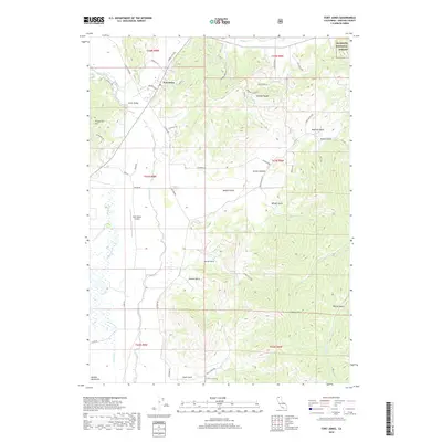
2018 Map of Fort Jones
USGS Topo · Published 2018About this map
Fort Jones sits as the central settlement in this high-relief portion of Scott Valley, where the valley floor meets the rising terrain of the Marble Mountains and the Klamath National Forest. The landscape is defined by the northward flow of the Scott River, joined by several tributaries including Kidder Cr and Patterson Cr. The western portion of the map is dominated by the prominent Chaparral Hill, while to the east, a series of steep drainages such as Hamlin Gulch, Hungry Hollow, and Sloans Gulch carve into the ridges. Transportation and local infrastructure are concentrated along the valley edges, evidenced by the Scott Valley Airport and a network of rural routes like Eastside Rd and Cemetery Rd. The transition from agricultural valley lands to the timbered heights of the National Forest is clearly delineated by the township and range boundaries.
Find a feature on this map
56 named features on this map. Tap any name to fly to it.
Don’t see what you’re looking for? This feature index may not catch every label — zoom into the map to look around manually.
Map Details
Editions of this 2018 Fort Jones Map
This is the sole edition of this map. No revisions or reprints were ever made.
Other maps of this area

1886 · Shasta
USGS Topo · 1:250,000

1894 · Shasta
USGS Topo · 1:250,000

1923 · Sawyers Bar
USGS Topo · 1:125,000

1931 · Etna
USGS Topo · 1:96,000

1932 · Yreka
USGS Topo · 1:96,000

1934 · Etna
USGS Topo · 1:125,000

1939 · Yreka
USGS Topo · 1:125,000

1948 · Weed
USGS Topo · 1:250,000

1950 · Weed
USGS Topo · 1:250,000

1954 · Yreka
USGS Topo · 1:62,500