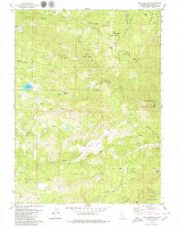
1979 Map of Fort Jones
USGS Topo · Published 1979About this map
The Stanislaus National Forest landscape shown here in the late 1970s is defined by a series of high ridges and deep watercourses where industrial history meets forest management. Mitchells Mill and several named lode claims, including the Black Wonder Mine, Fine Gold Mine, and Gold King Mine, speak to the region's enduring mining and timber legacy. The drainage network is complex, featuring the South Fork Mokelumne River in the north and the North Fork Calaveras River to the south, with the Calaveras Reservoir providing a significant point of water storage.
Find a feature on this map
49 named features on this map. Tap any name to fly to it.
Don’t see what you’re looking for? This feature index may not catch every label — zoom into the map to look around manually.
Map Details
Editions of this 1979 Fort Jones Map
This is the sole edition of this map. No revisions or reprints were ever made.
Other maps of this area

1886 · Shasta
USGS Topo · 1:250,000

1894 · Shasta
USGS Topo · 1:250,000

1923 · Sawyers Bar
USGS Topo · 1:125,000

1931 · Etna
USGS Topo · 1:96,000

1932 · Yreka
USGS Topo · 1:96,000

1934 · Etna
USGS Topo · 1:125,000
1939 · Yreka
USGS Topo · 1:125,000

1948 · Weed
USGS Topo · 1:250,000

1950 · Weed
USGS Topo · 1:250,000
1954 · Yreka
USGS Topo · 1:62,500