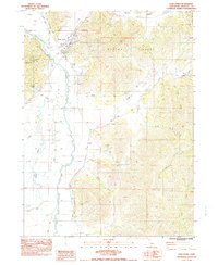
1984 Map of Fort Jones
USGS Topo · Published 1984About this map
Fort Jones serves as the primary hub of this northern California landscape, situated at the junction where the Mineral Range meets the fertile Scott Valley. The town's grid is clearly defined near the Scott River Ranger Station, while the surrounding alluvial plains are carved by the Scott River, Moffett Creek, and Kidder Creek. Local history is preserved in sites like the Cem and a lone Grave located north of the river, while the mid-1980s infrastructure is evidenced by the Scott Valley Airport and a prominent Passive Repeater on the ridge lines. The map reveals an economy tied to both the land and its resources, showing several Borrow Pits, a Quarry, and a Gravel Pit. To the east, the terrain becomes increasingly complex, with deep incisions like Hamlin Gulch and Hungry Hollow draining the mountain slopes toward the valley floor.
Find a feature on this map
37 named features on this map. Tap any name to fly to it.
Don’t see what you’re looking for? This feature index may not catch every label — zoom into the map to look around manually.
Map Details
Editions of this 1984 Fort Jones Map
This is the sole edition of this map. No revisions or reprints were ever made.
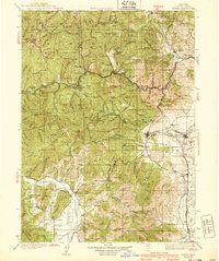
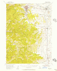
Other maps of this area

1886 · Shasta
USGS Topo · 1:250,000

1894 · Shasta
USGS Topo · 1:250,000

1923 · Sawyers Bar
USGS Topo · 1:125,000

1931 · Etna
USGS Topo · 1:96,000

1932 · Yreka
USGS Topo · 1:96,000

1934 · Etna
USGS Topo · 1:125,000
1939 · Yreka
USGS Topo · 1:125,000

1948 · Weed
USGS Topo · 1:250,000

1950 · Weed
USGS Topo · 1:250,000
1954 · Yreka
USGS Topo · 1:62,500