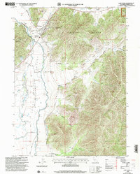
2001 Map of Fort Jones
USGS Topo · Published 2004About this map
Fort Jones sits at the northern edge of the fertile Scott Valley, serving as a gateway to the Klamath Nat For at the start of the 21st century. The map illustrates a landscape defined by the winding Scott River and its tributaries, including Kidder Creek and Moffett Creek, which support the region's agricultural character through the Valley Irrigation Ditch. Evidence of local heritage and infrastructure is present at the Fort Jones Historic Marker and the nearby Scott River and Salmon River Ranger Station.
Find a feature on this map
41 named features on this map. Tap any name to fly to it.
Don’t see what you’re looking for? This feature index may not catch every label — zoom into the map to look around manually.
Map Details
Editions of this 2001 Fort Jones Map
This is the sole edition of this map. No revisions or reprints were ever made.
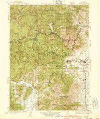
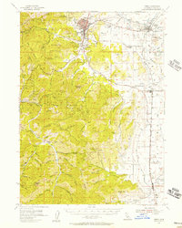
Other maps of this area

1886 · Shasta
USGS Topo · 1:250,000

1894 · Shasta
USGS Topo · 1:250,000

1923 · Sawyers Bar
USGS Topo · 1:125,000

1931 · Etna
USGS Topo · 1:96,000

1932 · Yreka
USGS Topo · 1:96,000

1934 · Etna
USGS Topo · 1:125,000
1939 · Yreka
USGS Topo · 1:125,000

1948 · Weed
USGS Topo · 1:250,000

1950 · Weed
USGS Topo · 1:250,000
1954 · Yreka
USGS Topo · 1:62,500