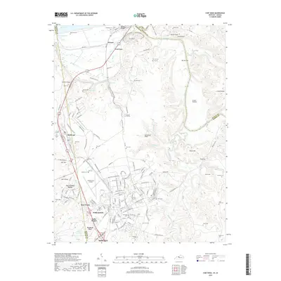
2019 Map of Fort Knox
USGS Topo · Published 2019About this map
Fort Duffield overlooks the confluence of the Ohio River and Salt River, marking a strategic vantage point in a landscape defined by the military infrastructure of Fort Knox. This area showcases a complex network of internal military roads like Carbine Range Rd and 484th Engineer Rd, alongside residential enclaves such as Rose Terrace, Gaffey Heights, and Van Voorhis Manor. The presence of Godman Army Airfield highlights the site's role as a major aviation and training hub.
Find a feature on this map
156 named features on this map. Tap any name to fly to it.
Don’t see what you’re looking for? This feature index may not catch every label — zoom into the map to look around manually.
Map Details
Editions of this 2019 Fort Knox Map
This is the sole edition of this map. No revisions or reprints were ever made.
Other maps of this area

1909 · Kosmosdale
USGS Topo · 1:48,000

1912 · Kosmosdale
USGS Topo · 1:62,500

1931 · Corydon
USGS Topo · 1:62,500

1936 · Vine Grove
USGS Topo · 1:62,500

1941 · Ekron
USGS Topo · 1:62,500

1943 · Vine Grove
USGS Topo · 1:62,500

1946 · Rock Haven
USGS Topo · 1:24,000

1946 · Pitts Point
USGS Topo · 1:24,000

1946 · Fort Knox
USGS Topo · 1:24,000

1946 · Colesburg
USGS Topo · 1:24,000