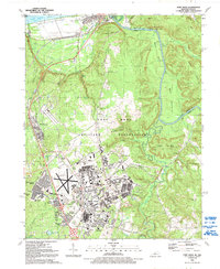
1991 Map of Fort Knox
USGS Topo · Published 1992About this map
The Fort Knox Military Reservation dominates this 1991 landscape, illustrating the complex overlap of 20th-century military infrastructure and older Kentucky settlements. Centered on the sprawling base and its Godman Army Airfield, the map reveals a high density of residential quarters such as Gaffey Heights and Prichard Place, contrasted against the preserved terrain of McClelland Branch and Hooker Mountain. To the north, the town of West Point sits at the strategic confluence of the Salt River and the Ohio River.
Find a feature on this map
82 named features on this map. Tap any name to fly to it.
Don’t see what you’re looking for? This feature index may not catch every label — zoom into the map to look around manually.
Map Details
Editions of this 1991 Fort Knox Map
This is the sole edition of this map. No revisions or reprints were ever made.
Other maps of this area

1909 · Kosmosdale
USGS Topo · 1:48,000

1912 · Kosmosdale
USGS Topo · 1:62,500

1931 · Corydon
USGS Topo · 1:62,500

1936 · Vine Grove
USGS Topo · 1:62,500

1941 · Ekron
USGS Topo · 1:62,500

1943 · Vine Grove
USGS Topo · 1:62,500

1946 · Rock Haven
USGS Topo · 1:24,000

1946 · Pitts Point
USGS Topo · 1:24,000

1946 · Fort Knox
USGS Topo · 1:24,000

1946 · Colesburg
USGS Topo · 1:24,000