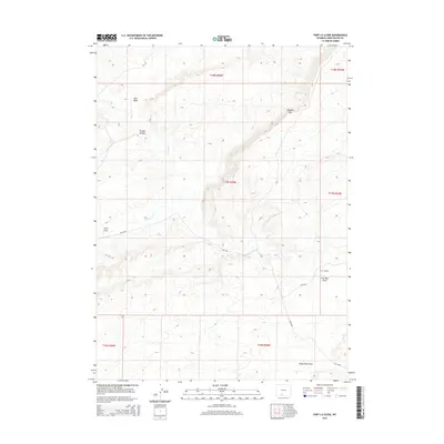
2015 Map of Fort La Clede
USGS Topo · Published 2015About this map
Fort LaClede stands as a focal point in this high-desert landscape of Sweetwater County, marking a site of enduring significance along the historical travel corridors of southern Wyoming. The drainage of Bitter Cr carves through the terrain, joined by seasonal watercourses like Antelope Cr and Red Wash. The topography is defined by the prominent Delaney Rim and several distinct geological depressions and drainages, including Hungry Hollow, Iron Pipe Draw, and Eagle Nest Draw. This survey captures the modern configuration of the land, showing the network of Bureau of Land Management routes such as BLM-4409 and BLM-4410 that provide access through these remote public lands. The map detail highlights the intersection of natural geography and human passage across the sagebrush steppe.
Find a feature on this map
17 named features on this map. Tap any name to fly to it.
Don’t see what you’re looking for? This feature index may not catch every label — zoom into the map to look around manually.
Map Details
Editions of this 2015 Fort La Clede Map
This is the sole edition of this map. No revisions or reprints were ever made.
Other maps of this area

1954 · Rock Springs
USGS Topo · 1:250,000

1958 · Rock Springs
USGS Topo · 1:250,000

1962 · Rock Springs
USGS Topo · 1:250,000

1968 · Bitter Creek
USGS Topo · 1:24,000

1968 · Sand Butte Rim SE
USGS Topo · 1:24,000
1968 · Antelope Flats
USGS Topo · 1:24,000
1970 · Kinney Spring
USGS Topo · 1:24,000

1970 · Table Rock
USGS Topo · 1:24,000

1970 · Manuel Gap
USGS Topo · 1:24,000

1970 · J O Dugway
USGS Topo · 1:24,000