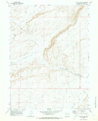
1970 Map of Fort La Clede
USGS Topo · Published 1973About this map
Fort La Clede (Ruins) and the La Clede Stage Sta (Ruins) anchor this 1970 snapshot of the Wyoming high desert, marking a critical corridor of westward expansion. The legendary Overland Trail cuts across the landscape, tracing a path through the sagebrush south of the prominent Delaney Rim. This era of the survey reveals the intersection of pioneer history and mid-century industry, as seen by the presence of an Oil Well north of Bitter Creek. The intricate drainage network of Antelope Creek, Laney Wash, and numerous draws like Hungry Hollow and Eagle Nest Draw illustrates the complex topography that travelers and early settlers navigated. The map documents the physical remains of the frontier's communication and defense infrastructure long after the primary stage lines had ceased operations.
Find a feature on this map
15 named features on this map. Tap any name to fly to it.
Don’t see what you’re looking for? This feature index may not catch every label — zoom into the map to look around manually.
Map Details
Editions of this 1970 Fort La Clede Map
This is the sole edition of this map. No revisions or reprints were ever made.
Other maps of this area

1954 · Rock Springs
USGS Topo · 1:250,000

1958 · Rock Springs
USGS Topo · 1:250,000

1962 · Rock Springs
USGS Topo · 1:250,000

1968 · Bitter Creek
USGS Topo · 1:24,000

1968 · Sand Butte Rim SE
USGS Topo · 1:24,000
1968 · Antelope Flats
USGS Topo · 1:24,000
1970 · Kinney Spring
USGS Topo · 1:24,000

1970 · Table Rock
USGS Topo · 1:24,000

1970 · Manuel Gap
USGS Topo · 1:24,000

1970 · J O Dugway
USGS Topo · 1:24,000