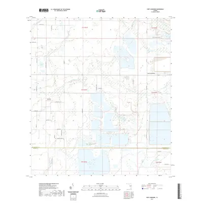
2021 Map of Fort Lonesome
USGS Topo · Published 2021About this map
Fort Lonesome serves as the focal point of this rural Florida landscape, where the headwaters of the Alafia and Little Manatee river systems converge. The terrain is defined by a complex network of wetlands and drainage features, including the S Prong Alafia River in the northeast and the Little Manatee River cutting through the central sections. Large-scale agricultural and land management practices are evident in the township and range divisions, while the Gyro Town USA Airport provides a distinct aviation landmark in the western portion of the quadrangle. The hydrography is particularly rich, featuring named bodies such as Carlton Lake and the expansive Howard Prairie, which transitions into the Howard Prairie Branch. This 2021 survey illustrates the rural character of the Hillsborough and Manatee county line, documented before further suburban expansion might alter these traditional ranching and agricultural lands.
Find a feature on this map
49 named features on this map. Tap any name to fly to it.
Don’t see what you’re looking for? This feature index may not catch every label — zoom into the map to look around manually.
Map Details
Editions of this 2021 Fort Lonesome Map
This is the sole edition of this map. No revisions or reprints were ever made.
Other maps of this area

1921 · Tampa
USGS Topo · 1:62,500

1944 · Rye
USGS Topo · 1:31,680

1944 · Wimauma
USGS Topo · 1:31,680

1944 · Balm
USGS Topo · 1:31,680

1947 · Wimauma
USGS Topo · 1:25,000

1955 · Lithia
USGS Topo · 1:24,000

1955 · Keysville
USGS Topo · 1:24,000
1956 · Riverview
USGS Topo · 1:24,000

1956 · Ft Lonesome
USGS Topo · 1:24,000

1956 · Duette NE
USGS Topo · 1:24,000
Featured Places
- Alderman-Carlton Ranchettes, FL
- Fort Lonesome, FL
- Hillsborough County, FL
- Manatee County, FL
- United States