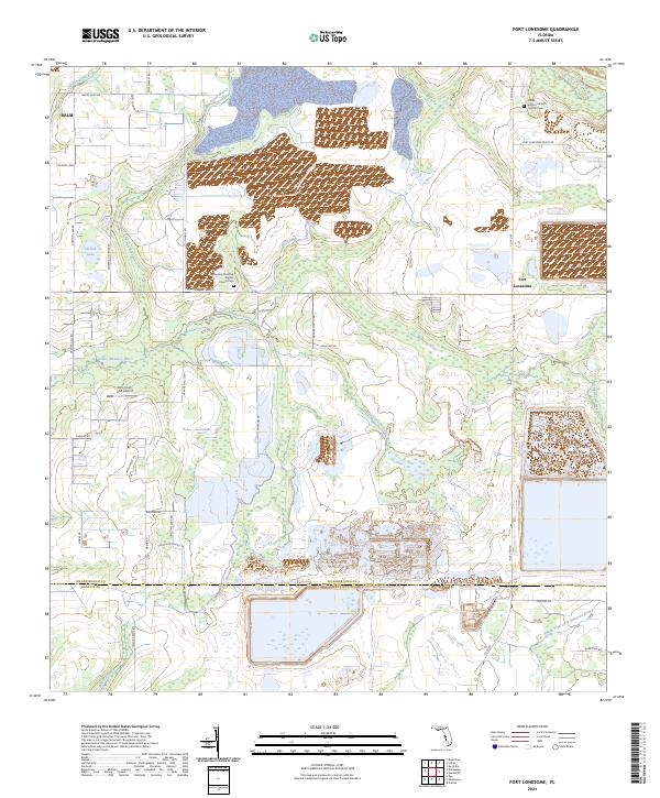
2024 Map of Fort Lonesome
USGS Topo · Published 2024About this map
Fort Lonesome and the nearby community of Balm anchor this survey of southern Hillsborough County, where the landscape transitions between agricultural tracts and industrial mining operations. The headwaters and tributaries of several major regional waterways define the terrain, notably the Little Manatee River and the South Prong Alafia River. Rural life is centered around local institutions like the Fellowship Primitive Baptist Church Cem and the Alafia Baptist Church Hurrah Cem, which serve as vital markers for local genealogy.
Find a feature on this map
51 named features on this map. Tap any name to fly to it.
Don’t see what you’re looking for? This feature index may not catch every label — zoom into the map to look around manually.
Map Details
Editions of this 2024 Fort Lonesome Map
This is the sole edition of this map. No revisions or reprints were ever made.
Other maps of this area

1921 · Tampa
USGS Topo · 1:62,500

1944 · Rye
USGS Topo · 1:31,680

1944 · Wimauma
USGS Topo · 1:31,680

1944 · Balm
USGS Topo · 1:31,680

1947 · Wimauma
USGS Topo · 1:25,000

1955 · Lithia
USGS Topo · 1:24,000

1955 · Keysville
USGS Topo · 1:24,000
1956 · Riverview
USGS Topo · 1:24,000

1956 · Ft Lonesome
USGS Topo · 1:24,000

1956 · Duette NE
USGS Topo · 1:24,000
Featured Places
- Alderman-Carlton Ranchettes, FL
- Fort Lonesome, FL
- Hillsborough County, FL
- Manatee County, FL
- United States