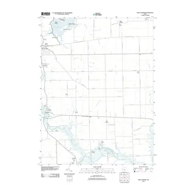
2010 Map of Fort Loramie
USGS Topo · Published 2010About this map
Lake Loramie and its cluster of islands, including Earls Island and Blackberry Island, anchor the northern reaches of this Shelby County landscape. The drainage network is heavily modified for agriculture, characterized by straightened watercourses like Webner Ditch, Ellerman Ditch, and Gaier Ditch that cut across the section lines. This rural infrastructure supports a series of small, long-established communities such as Fort Loramie, Houston, and Saint Patrick.
Find a feature on this map
70 named features on this map. Tap any name to fly to it.
Don’t see what you’re looking for? This feature index may not catch every label — zoom into the map to look around manually.
Map Details
Editions of this 2010 Fort Loramie Map
This is the sole edition of this map. No revisions or reprints were ever made.
Other maps of this area

1909 · Loramie
USGS Topo · 1:62,500

1911 · Loramie
USGS Topo · 1:62,500

1911 · Covington
USGS Topo · 1:62,500

1913 · Sidney
USGS Topo · 1:62,500

1914 · Troy
USGS Topo · 1:62,500

1944 · Covington
USGS Topo · 1:62,500

1944 · Sidney
USGS Topo · 1:62,500

1944 · Loramie
USGS Topo · 1:62,500

1944 · Troy
USGS Topo · 1:62,500

1953 · Muncie
USGS Topo · 1:250,000