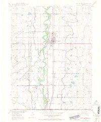
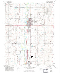
1949 Map of Fort Lupton
USGS Topo · Published 1966About this map
The South Platte River carves a winding path through this 1949 landscape, anchoring a complex network of agricultural irrigation in Weld and Adams counties. The settlement of Fort Lupton serves as a central hub, flanked by the Union Pacific railroad and a dense grid of canals including the Fulton Canal, Lupton Bottom Ditch, and Brighton Ditch. These waterways illustrate the intensive engineering required to sustain the region's high-plains farming economy during the post-war era.
Find a feature on this map
24 named features on this map. Tap any name to fly to it.
Don’t see what you’re looking for? This feature index may not catch every label — zoom into the map to look around manually.
Map Details
Editions of this 1949 Fort Lupton Map
6 editions found
Other maps of this area

1890 · East Denver
USGS Topo · 1:125,000

1902 · Greeley
USGS Topo · 1:125,000

1940 · Brighton
USGS Topo · 1:31,680

1940 · Eastlake
USGS Topo · 1:31,680

1942 · Mile High Lakes
USGS Topo · 1:31,680

1944 · Brighton
USGS Topo · 1:31,680

1944 · Eastlake
USGS Topo · 1:31,680

1949 · Gowanda
USGS Topo · 1:24,000

1949 · Fort Lupton
USGS Topo · 1:24,000

1949 · Platteville
USGS Topo · 1:24,000