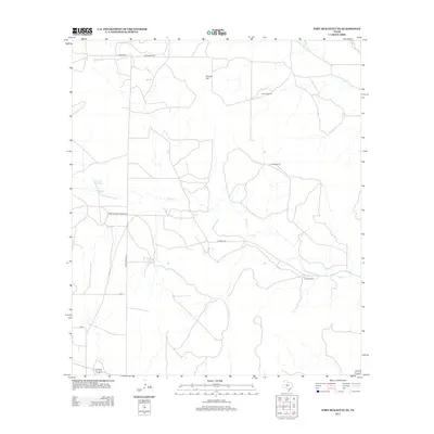
2012 Map of Fort McKavett NE
USGS Topo · Published 2012About this map
White Ranch and Russell Ranch anchor this West Texas ranching landscape in Schleicher County, where the topography is defined by the ephemeral drainages of the Edwards Plateau. The presence of Eaker Windmill and the Ninemile Waterhole reflects the critical importance of water management in this arid environment. The terrain is marked by gradual elevations like Round Hill, with seasonal watercourses including Rocky Cr and Dry Cr carving through the limestone-based soil. Transportation throughout the area is served by a network of rural routes, notably Farm-To-Market Road 2873 and Ranch Road 2873, which connect these isolated homesteads and pastures to the wider region. This 2012 survey provides a clear view of contemporary land use, showing how legacy ranching operations continue to utilize natural features and established rural road systems.
Find a feature on this map
12 named features on this map. Tap any name to fly to it.
Don’t see what you’re looking for? This feature index may not catch every label — zoom into the map to look around manually.
Map Details
Editions of this 2012 Fort McKavett NE Map
This is the sole edition of this map. No revisions or reprints were ever made.
Other maps of this area

1892 · San Angelo
USGS Topo · 1:125,000

1892 · Eden
USGS Topo · 1:125,000

1893 · Fort McKavett
USGS Topo · 1:125,000

1896 · Eden
USGS Topo · 1:125,000

1954 · Brownwood
USGS Topo · 1:250,000

1954 · Llano
USGS Topo · 1:250,000

1954 · Sonora
USGS Topo · 1:250,000

1954 · San Angelo
USGS Topo · 1:250,000

1955 · Llano
USGS Topo · 1:250,000

1956 · Llano
USGS Topo · 1:250,000