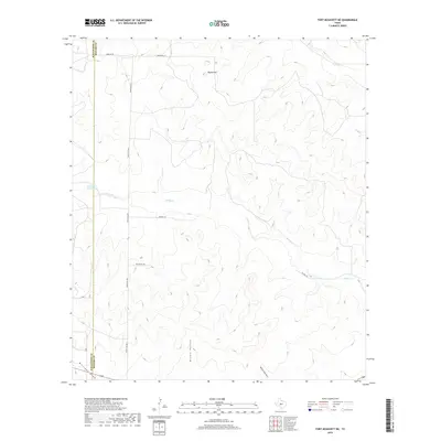
2019 Map of Fort McKavett NE
USGS Topo · Published 2019About this map
The boundary between Schleicher Co and Menard Co cuts through this high-plains landscape in West Texas, where the topography is defined by significant drainage systems. Rocky Cr and Dry Cr carve across the terrain, while prominent landmarks like Round Hill and the deep incision of Brown Hollow indicate the varied elevation of the Edwards Plateau. The presence of Ninemile Waterhole highlights a critical water source in an area otherwise characterized by ephemeral waterways like Rattlesnake Draw and Milligan Draw. A sparse network of local roads and cattle paths, including Ranch Rd 2873, Norman Rd, and BSA Ranch Rd, connects the various ranches and seasonal tracks that define the land use in this corner of the state.
Find a feature on this map
13 named features on this map. Tap any name to fly to it.
Don’t see what you’re looking for? This feature index may not catch every label — zoom into the map to look around manually.
Map Details
Editions of this 2019 Fort McKavett NE Map
This is the sole edition of this map. No revisions or reprints were ever made.
Other maps of this area

1892 · San Angelo
USGS Topo · 1:125,000

1892 · Eden
USGS Topo · 1:125,000

1893 · Fort McKavett
USGS Topo · 1:125,000

1896 · Eden
USGS Topo · 1:125,000

1954 · Brownwood
USGS Topo · 1:250,000

1954 · Llano
USGS Topo · 1:250,000

1954 · Sonora
USGS Topo · 1:250,000

1954 · San Angelo
USGS Topo · 1:250,000

1955 · Llano
USGS Topo · 1:250,000

1956 · Llano
USGS Topo · 1:250,000