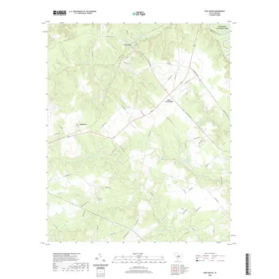
2020 Map of Fort Motte
USGS Topo · Published 2020About this map
Fort Motte and the surrounding Calhoun County landscape are defined by a complex network of wetlands and tributaries flowing toward the Congaree River. In the northern portion of the map, the Congaree National Park marks the transition into the dense river bottomlands, while the upland areas feature small settlements such as Wiles Crossroads and Singleton. This 2020 record illustrates a rural terrain deeply carved by water, where numerous named branches and creeks like Halfway Swamp Cr and True Blue Cr feed into localized water bodies, including True Blue Lake and Shay Hane Cabin Pond. The road network, including the historic McCords Ferry Rd and Fort Motte Rd, reflects long-standing transit patterns that have connected these small communities for generations. Many landmarks, such as Reid House Pond and Wiles Pond, carry family names that provide significant leads for local genealogists tracing land ownership in the region.
Find a feature on this map
65 named features on this map. Tap any name to fly to it.
Don’t see what you’re looking for? This feature index may not catch every label — zoom into the map to look around manually.
Map Details
Editions of this 2020 Fort Motte Map
This is the sole edition of this map. No revisions or reprints were ever made.
Other maps of this area

1943 · Eastover
USGS Topo · 1:62,500

1946 · Elloree
USGS Topo · 1:62,500

1946 · St. Matthews
USGS Topo · 1:62,500

1948 · Hopkins
USGS Topo · 1:62,500

1953 · Poinsett State Park
USGS Topo · 1:24,000

1953 · Gadsden
USGS Topo · 1:24,000

1953 · Wateree
USGS Topo · 1:24,000

1954 · Augusta
USGS Topo · 1:250,000

1957 · Augusta
USGS Topo · 1:250,000

1958 · Augusta
USGS Topo · 1:250,000