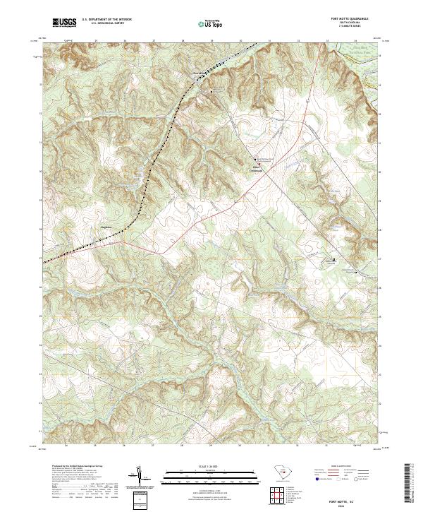
2024 Map of Fort Motte
USGS Topo · Published 2024About this map
Fort Motte serves as a central anchor for this area of Calhoun County, where the landscape is defined by the transition from upland ridges to the wetlands of the Santee River basin. The settlement patterns follow high ground, notably at Wiles Crossroads and Singleton, connected by a network of rural roads such as Fort Motte Rd and McCoords Ferry Rd. For those tracing local history, several prominent churchyards provide significant genealogical reference points, including Mount Pisgah Church & Graveyard and Saint Matthews Parish Church Graveyard. The northeastern corner of the map reaches into the protected wilderness of Congaree National Park, while the interior is drained by numerous streams like Warley Creek and Halfway Swamp Creek, feeding into larger bodies such as True Blue Lake and Holman Pond.
Find a feature on this map
73 named features on this map. Tap any name to fly to it.
Don’t see what you’re looking for? This feature index may not catch every label — zoom into the map to look around manually.
Map Details
Editions of this 2024 Fort Motte Map
This is the sole edition of this map. No revisions or reprints were ever made.
Other maps of this area

1943 · Eastover
USGS Topo · 1:62,500

1946 · Elloree
USGS Topo · 1:62,500

1946 · St. Matthews
USGS Topo · 1:62,500

1948 · Hopkins
USGS Topo · 1:62,500

1953 · Poinsett State Park
USGS Topo · 1:24,000

1953 · Gadsden
USGS Topo · 1:24,000

1953 · Wateree
USGS Topo · 1:24,000

1954 · Augusta
USGS Topo · 1:250,000

1957 · Augusta
USGS Topo · 1:250,000

1958 · Augusta
USGS Topo · 1:250,000