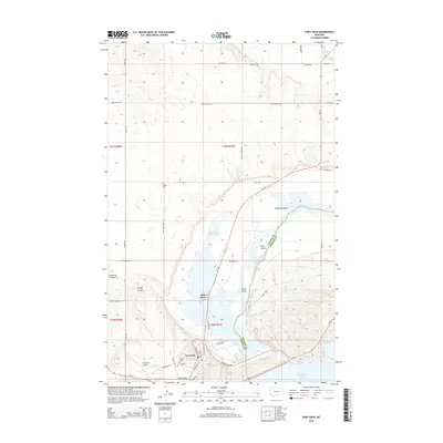
2014 Map of Fort Peck
USGS Topo · Published 2014About this map
Fort Peck sits at the northern edge of the Missouri River's massive impoundment, serving as a focal point for this landscape defined by the convergence of the Missouri River and the Milk River. The town's grid is detailed with street names such as N Bighorn St, Yellowstone Rd, and Missouri Ave, indicating the planned nature of this settlement. Just to the north, Park Grove and the Fort Peck Trout Pond highlight the recreational and residential development following the dam's creation.
Find a feature on this map
48 named features on this map. Tap any name to fly to it.
Don’t see what you’re looking for? This feature index may not catch every label — zoom into the map to look around manually.
Map Details
Editions of this 2014 Fort Peck Map
This is the sole edition of this map. No revisions or reprints were ever made.
Other maps of this area

1914 · Nashua
USGS Topo · 1:62,500

1916 · Nashua
USGS Topo · 1:62,500

1943 · Glasgow
USGS Topo · 1:125,000

1954 · Jordan
USGS Topo · 1:250,000

1954 · Glasgow
USGS Topo · 1:250,000

1956 · Jordan
USGS Topo · 1:250,000

1957 · Glasgow
USGS Topo · 1:250,000

1958 · Glasgow
USGS Topo · 1:250,000

1958 · Jordan
USGS Topo · 1:250,000

1958 · Wheeler
USGS Topo · 1:24,000