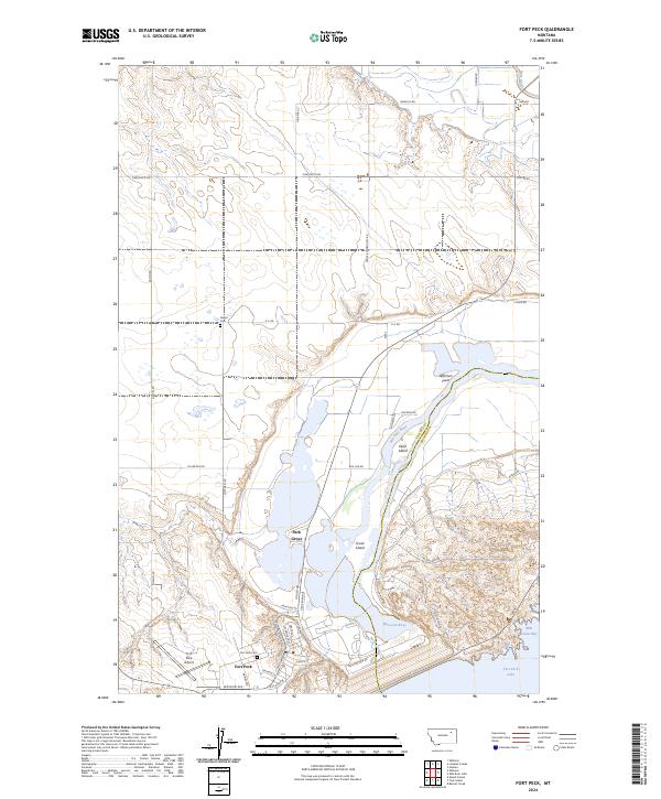
2024 Map of Fort Peck
USGS Topo · Published 2024About this map
The Missouri River and Milk River converge in this high-plains landscape, dominated by the massive engineering legacy at Fort Peck. The townsite itself, established to support the construction of the nearby dam, sits just west of the river along streets like Marias Ave and Missouri Ave. To the north, the small settlement of Park Grove marks a distinct cluster of development near the riverbank. This survey captures the transition from the structured residential blocks of the town to the expansive reaches of the Charles M Russell National Wildlife Refuge, which encompasses significant terrain including Duck Island and Scout Island. Local history is anchored by sites like the Fort Peck Cem and Galpin Cem, while the industrial and transportation needs of the region are reflected at the Fort Peck Airport. The map highlights the complex intersection of water management and wilderness preservation in Valley County.
Find a feature on this map
49 named features on this map. Tap any name to fly to it.
Don’t see what you’re looking for? This feature index may not catch every label — zoom into the map to look around manually.
Map Details
Editions of this 2024 Fort Peck Map
This is the sole edition of this map. No revisions or reprints were ever made.
Other maps of this area

1914 · Nashua
USGS Topo · 1:62,500

1916 · Nashua
USGS Topo · 1:62,500

1943 · Glasgow
USGS Topo · 1:125,000

1954 · Jordan
USGS Topo · 1:250,000

1954 · Glasgow
USGS Topo · 1:250,000

1956 · Jordan
USGS Topo · 1:250,000

1957 · Glasgow
USGS Topo · 1:250,000

1958 · Glasgow
USGS Topo · 1:250,000

1958 · Jordan
USGS Topo · 1:250,000

1958 · Wheeler
USGS Topo · 1:24,000