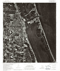
1972 Map of Fort Pierce
USGS Topo · Published 1975About this map
Coastal development along the Indian River defines this orthophotoquad, which uses experimental metric hypsography to document the shoreline and bathymetry during the early 1970s. The dense residential and commercial grid of Fort Pierce is visible as it meets the lagoon, contrasting sharply with the undeveloped barrier island and the deep contours of the Atlantic Ocean. To the northwest, the St Lucie County Airport stands out as a prominent landmark of the region's infrastructure. This specific survey was a collaborative effort between federal agencies and the State of Florida, utilizing aerial photography from 1972 to provide a clear, photographic view of the city's growth and the shifting sands of the Florida coast before modern expansion further altered the waterfront.
Find a feature on this map
3 named features on this map. Tap any name to fly to it.
Don’t see what you’re looking for? This feature index may not catch every label — zoom into the map to look around manually.
Map Details
Editions of this 1972 Fort Pierce Map
2 editions found
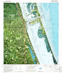
Other maps of this area

1948 · Ankona
USGS Topo · 1:24,000

1948 · Eden
USGS Topo · 1:24,000

1948 · Indrio
USGS Topo · 1:24,000

1949 · Fort Pierce
USGS Topo · 1:24,000

1949 · Oslo
USGS Topo · 1:24,000

1949 · Fort Pierce NW
USGS Topo · 1:24,000

1950 · Ankona
USGS Topo · 1:24,000

1950 · Fort Pierce
USGS Topo · 1:24,000

1950 · Fort Pierce NW
USGS Topo · 1:24,000

1950 · Oslo
USGS Topo · 1:24,000