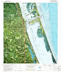
1972 Map of Fort Pierce
USGS Topo · Published 1975About this map
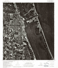
The Fort Pierce waterfront is the focal point of this orthophotomap, showing the mid-1970s development of the Treasure Coast. This hybrid survey combines traditional bathymetric data with aerial imagery, detailing the complex aquatic geography of the Indian River and the Fort Pierce Inlet. Significant maritime infrastructure is visible, including the Municipal Yacht Basin, several spoil banks, and the U S Coast Guard station at Faber Pt. The map reveals the expansion of residential districts like Paradise Park and the industrial influence of the Florida East Coast railway corridor.
Find a feature on this map
52 named features on this map. Tap any name to fly to it.
Don’t see what you’re looking for? This feature index may not catch every label — zoom into the map to look around manually.
Map Details
Editions of this 1972 Fort Pierce Map
2 editions found
Other maps of this area

1948 · Ankona
USGS Topo · 1:24,000

1948 · Eden
USGS Topo · 1:24,000

1948 · Indrio
USGS Topo · 1:24,000

1949 · Fort Pierce
USGS Topo · 1:24,000

1949 · Oslo
USGS Topo · 1:24,000

1949 · Fort Pierce NW
USGS Topo · 1:24,000

1950 · Ankona
USGS Topo · 1:24,000

1950 · Fort Pierce
USGS Topo · 1:24,000

1950 · Fort Pierce NW
USGS Topo · 1:24,000

1950 · Oslo
USGS Topo · 1:24,000