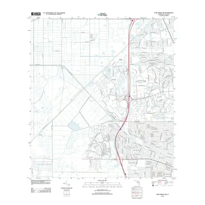
2012 Map of Fort Pierce SW
USGS Topo · Published 2012About this map
Indian River Community College stands as a central landmark in this developing coastal Florida landscape, where the transition from citrus groves and rural agricultural plots to residential subdivisions is well underway. The northern and western portions of the quadrangle, around Carlton and Cana, retain a grid-like drainage and transport system characterized by long straight routes such as S Header Canal Rd and Hammock Ln. These deep-water management features, including C-24 Canal Rd, were essential for the region's agricultural productivity before the suburban expansion of Port Saint Lucie. Further east, the map reveals an intricate network of modern residential naming conventions, with winding roads like NW Torino Pkwy and NW Wesley Rd replacing the earlier, more linear rural patterns of Peacock Rd and Williams Rd.
Find a feature on this map
211 named features on this map. Tap any name to fly to it.
Don’t see what you’re looking for? This feature index may not catch every label — zoom into the map to look around manually.
Map Details
Editions of this 2012 Fort Pierce SW Map
This is the sole edition of this map. No revisions or reprints were ever made.
Other maps of this area

1948 · Palm City
USGS Topo · 1:24,000

1948 · Ankona
USGS Topo · 1:24,000

1949 · Fort Pierce
USGS Topo · 1:24,000

1949 · Fort Pierce NW
USGS Topo · 1:24,000

1950 · Ankona
USGS Topo · 1:24,000

1950 · Fort Pierce
USGS Topo · 1:24,000

1950 · Palm City
USGS Topo · 1:24,000

1950 · Fort Pierce NW
USGS Topo · 1:24,000

1953 · Okeechobee 1 SE
USGS Topo · 1:24,000

1953 · Okeechobee 4 NE
USGS Topo · 1:24,000