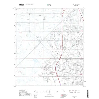
2018 Map of Fort Pierce SW
USGS Topo · Published 2018About this map
Port St. Lucie is shown during a period of significant suburban expansion, where traditional agricultural and canal-side landscapes meet new residential developments. The area's equestrian and rural character is still evident in the northwest through labels like Thoroughbred Dr, Clydesdale Ln, and Saddlebrook Dr. In contrast, the eastern portion of the sheet reflects modern planning, centered around specialized institutions such as the Keiser Univ College of Golf and Sport Management and several golf course communities.
Find a feature on this map
248 named features on this map. Tap any name to fly to it.
Don’t see what you’re looking for? This feature index may not catch every label — zoom into the map to look around manually.
Map Details
Editions of this 2018 Fort Pierce SW Map
This is the sole edition of this map. No revisions or reprints were ever made.
Other maps of this area

1948 · Palm City
USGS Topo · 1:24,000

1948 · Ankona
USGS Topo · 1:24,000

1949 · Fort Pierce
USGS Topo · 1:24,000

1949 · Fort Pierce NW
USGS Topo · 1:24,000

1950 · Ankona
USGS Topo · 1:24,000

1950 · Fort Pierce
USGS Topo · 1:24,000

1950 · Palm City
USGS Topo · 1:24,000

1950 · Fort Pierce NW
USGS Topo · 1:24,000

1953 · Okeechobee 1 SE
USGS Topo · 1:24,000

1953 · Okeechobee 4 NE
USGS Topo · 1:24,000