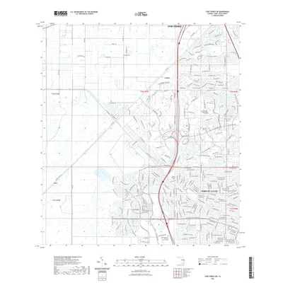
2021 Map of Fort Pierce SW
USGS Topo · Published 2021About this map
Port St. Lucie expands across the southeastern quadrant of this survey, showcasing a dense network of suburban development defined by winding residential lanes and planned communities. The landscape is heavily influenced by water management infrastructure, most notably the prominent Rim Ditch and the C-24 Canal Rd, which bisect the terrain alongside Co Rd 709. Educational hubs are established within the growing city, including the Indian River State College Pruitt Campus and the Keiser University Port Saint Lucie Campus.
Find a feature on this map
247 named features on this map. Tap any name to fly to it.
Don’t see what you’re looking for? This feature index may not catch every label — zoom into the map to look around manually.
Map Details
Editions of this 2021 Fort Pierce SW Map
This is the sole edition of this map. No revisions or reprints were ever made.
Other maps of this area

1948 · Palm City
USGS Topo · 1:24,000

1948 · Ankona
USGS Topo · 1:24,000

1949 · Fort Pierce
USGS Topo · 1:24,000

1949 · Fort Pierce NW
USGS Topo · 1:24,000

1950 · Ankona
USGS Topo · 1:24,000

1950 · Fort Pierce
USGS Topo · 1:24,000

1950 · Palm City
USGS Topo · 1:24,000

1950 · Fort Pierce NW
USGS Topo · 1:24,000

1953 · Okeechobee 1 SE
USGS Topo · 1:24,000

1953 · Okeechobee 4 NE
USGS Topo · 1:24,000