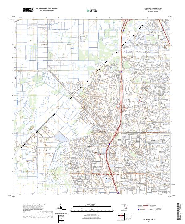
2024 Map of Fort Pierce SW
USGS Topo · Published 2024About this map
Port St. Lucie and the unincorporated community of Carlton anchor this detailed study of Saint Lucie County’s expanding residential and educational footprint. The landscape is defined by its complex network of canals and managed waterways, including the C-24 Canal-Rd and the Rim Ditch, which intersect the systematic grid of township and range boundaries. This map captures a significant concentration of institutional landmarks, notably the Indian River State College Pruitt Campus and the Keiser University—Port Saint Lucie Campus, signaling the area's role as a regional hub for higher education.
Find a feature on this map
63 named features on this map. Tap any name to fly to it.
Don’t see what you’re looking for? This feature index may not catch every label — zoom into the map to look around manually.
Map Details
Editions of this 2024 Fort Pierce SW Map
This is the sole edition of this map. No revisions or reprints were ever made.
Other maps of this area

1948 · Palm City
USGS Topo · 1:24,000

1948 · Ankona
USGS Topo · 1:24,000

1949 · Fort Pierce
USGS Topo · 1:24,000

1949 · Fort Pierce NW
USGS Topo · 1:24,000

1950 · Ankona
USGS Topo · 1:24,000

1950 · Fort Pierce
USGS Topo · 1:24,000

1950 · Palm City
USGS Topo · 1:24,000

1950 · Fort Pierce NW
USGS Topo · 1:24,000

1953 · Okeechobee 1 SE
USGS Topo · 1:24,000

1953 · Okeechobee 4 NE
USGS Topo · 1:24,000