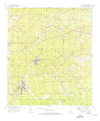
1974 Map of Fort Polk
USGS Topo · Published 1975About this map
The Fort Polk Military Reservation dominates this central Louisiana landscape, showing a complex network of training grounds and logistical hubs during the mid-1970s. The installation is anchored by the North Fort Polk cantonment area and the Fort Polk Army Airfield, surrounded by specialized landmarks like Artillery Lake, Engineer Lake, and numerous firing ranges. Outside the military boundaries, the piney woods of the Kisatchie National Forest provide a contrast of managed wilderness, though the legacy of earlier eras is visible through several old RR grades and the active Kansas City Southern line in the southwest corner.
Find a feature on this map
93 named features on this map. Tap any name to fly to it.
Don’t see what you’re looking for? This feature index may not catch every label — zoom into the map to look around manually.
Map Details
Editions of this 1974 Fort Polk Map
This is the sole edition of this map. No revisions or reprints were ever made.
Other maps of this area

1937 · Chopin SW
USGS Topo · 1:31,680

1941 · Leesville
USGS Topo · 1:62,500

1941 · Slagle
USGS Topo · 1:62,500

1942 · Florien
USGS Topo · 1:62,500

1942 · Kisatchie
USGS Topo · 1:62,500

1943 · Leesville
USGS Topo · 1:62,500

1943 · Leander
USGS Topo · 1:62,500

1943 · Kisatchie
USGS Topo · 1:62,500

1944 · Chopin
USGS Topo · 1:62,500

1944 · Florien
USGS Topo · 1:62,500