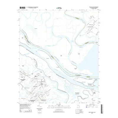
2014 Map of Fort Pulaski
USGS Topo · Published 2014About this map
Fort Pulaski National Monument commands the marshes and islands where the Savannah River meets the Atlantic, anchoring a landscape defined by intricate tidal waterways and coastal residential growth. This 2014 survey captures the interface of Georgia and South Carolina, where the Intracoastal Waterway and Fields Cut thread through a series of islands including Daufuskie Island, Jones Island, and McQueens Island. The transition from historic maritime sites to modern suburban communities is evident in the residential clusters on Whitemarsh Island and Wilmington Island, featuring neighborhoods like Golden Isles and River Oaks. On the South Carolina side, Daufuskie Landing and the Mary Field Cem reflect the long-standing community life on these sea islands, accessible primarily by water via the New River and Wright River. The mapping of small features like the Lee Shore Marina and the Spence Grayson Bridge provides a record of the modern infrastructure supporting this coastal environment.
Find a feature on this map
129 named features on this map. Tap any name to fly to it.
Don’t see what you’re looking for? This feature index may not catch every label — zoom into the map to look around manually.
Map Details
Editions of this 2014 Fort Pulaski Map
This is the sole edition of this map. No revisions or reprints were ever made.
Other maps of this area

1920 · Wassaw Sound
USGS Topo · 1:62,500

1920 · Bluffton
USGS Topo · 1:62,500

1942 · Savannah
USGS Topo · 1:62,500

1944 · Ossabaw Island
USGS Topo · 1:62,500

1945 · Bluffton
USGS Topo · 1:62,500

1945 · Ossabaw Island
USGS Topo · 1:62,500

1945 · Wassaw Sound
USGS Topo · 1:62,500

1946 · Brunswick
USGS Topo · 1:250,000

1947 · Savannah
USGS Topo · 1:250,000

1948 · Brunswick
USGS Topo · 1:250,000