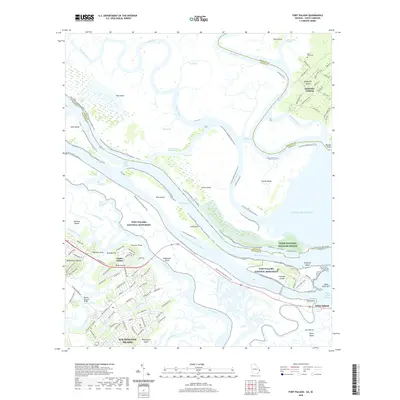
2020 Map of Fort Pulaski
USGS Topo · Published 2020About this map
Fort Pulaski National Monument commands the entrance to the Savannah River on Cockspur Island, anchoring a landscape defined by complex tidal waterways and coastal marshlands. This modern survey illustrates the coastal geography where the South Channel Savannah River meets the Atlantic Ocean. The map documents a diverse mix of protected lands and residential growth, from the Tybee National Wildlife Refuge to developed areas on Wilmington Island and Talahi Island. Maritime heritage is visible through features like the Lighthouse Overlook Trail and the McQueens Island Historic Trail, which follows an old rail alignment. To the north, across the state line in South Carolina, Daufuskie Island maintains a more secluded character with Daufuskie Landing and the Mary Field Cem set amidst a network of tidal cuts including Cooks Cut and Walls Cut.
Find a feature on this map
118 named features on this map. Tap any name to fly to it.
Don’t see what you’re looking for? This feature index may not catch every label — zoom into the map to look around manually.
Map Details
Editions of this 2020 Fort Pulaski Map
This is the sole edition of this map. No revisions or reprints were ever made.
Other maps of this area

1920 · Wassaw Sound
USGS Topo · 1:62,500

1920 · Bluffton
USGS Topo · 1:62,500

1942 · Savannah
USGS Topo · 1:62,500

1944 · Ossabaw Island
USGS Topo · 1:62,500

1945 · Bluffton
USGS Topo · 1:62,500

1945 · Ossabaw Island
USGS Topo · 1:62,500

1945 · Wassaw Sound
USGS Topo · 1:62,500

1946 · Brunswick
USGS Topo · 1:250,000

1947 · Savannah
USGS Topo · 1:250,000

1948 · Brunswick
USGS Topo · 1:250,000