
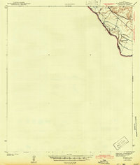
1943 Map of Fort Quitman
USGS Topo · Published 1943About this map
Fort Quitman stands on the northern bank of the Rio Grande in this early 1940s survey of the Texas-Mexico borderlands. This arid landscape in Hudspeth County is defined by the sharp contrast between the irrigated valley floor and the rising Quitman Mountains to the east. Infrastructure of the era is concentrated along the river and the northern rail corridor, where the Texas and Pacific Southern Pacific line passes through Madden. The map documents a scattered network of rural education and ranching life, including Quitman Sch, Bean Sch, and Cox Sch, alongside family-named holdings like Gills Ranch and McClintock Ranch. Of particular interest to mining historians is the Bonanza Mine located high in the mountains near Silver King Can. The presence of the Esperanza Canal and Lower Canal illustrates the intensive water management required to support border settlements like Esperanza.
Find a feature on this map
33 named features on this map. Tap any name to fly to it.
Don’t see what you’re looking for? This feature index may not catch every label — zoom into the map to look around manually.
Map Details
Editions of this 1943 Fort Quitman Map
This is the sole edition of this map. No revisions or reprints were ever made.
Other maps of this area

1894 · Fort Hancock
USGS Topo · 1:125,000

1895 · Sierra Blanca
USGS Topo · 1:125,000

1897 · Eagle Mountain
USGS Topo · 1:125,000

1916 · Eagle Mountain
USGS Topo · 1:125,000

1943 · Finlay Mountains
USGS Topo · 1:62,500

1943 · Fort Hancock
USGS Topo · 1:62,500
1943 · McNary
USGS Topo · 1:62,500

1948 · Triple Hill
USGS Topo · 1:62,500

1954 · Van Horn
USGS Topo · 1:250,000

1958 · Van Horn
USGS Topo · 1:250,000