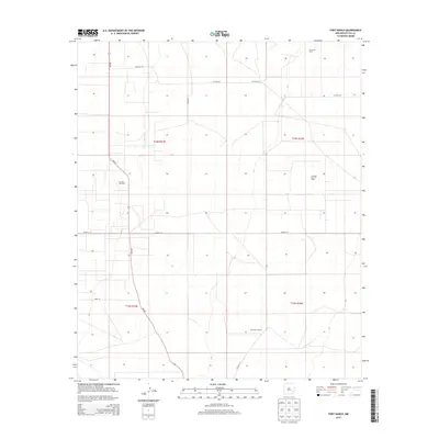
2013 Map of Fort Ranch
USGS Topo · Published 2013About this map
Fort Ranch and Etcheverry Ranch sit within the high plains of Lea County, characterizing the ranching and resource extraction economy of southeastern New Mexico in the early 21st century. The landscape is defined by a systematic grid of section lines and range markers, including t14s r33e, t14s r34e, and t15s r33e. Petroleum production is a dominant feature of this terrain, with several established zones including the Saunders Oil Field, the Saunders East Oil Field, and the Cerca Oil Field concentrated in the northern and central portions of the quadrangle. Transportation across these open ranges is facilitated by a network of local routes like Warren Rd and Jerry Ln, alongside state highway NM-457. The map illustrates the specialized infrastructure required for desert ranching and energy development, where isolated homesteads serve as anchors in an expansive, industrial-agricultural landscape.
Find a feature on this map
15 named features on this map. Tap any name to fly to it.
Don’t see what you’re looking for? This feature index may not catch every label — zoom into the map to look around manually.
Map Details
Editions of this 2013 Fort Ranch Map
This is the sole edition of this map. No revisions or reprints were ever made.
Other maps of this area

1954 · Hobbs
USGS Topo · 1:250,000

1954 · Brownfield
USGS Topo · 1:250,000

1958 · Brownfield
USGS Topo · 1:250,000

1958 · Hobbs
USGS Topo · 1:250,000

1962 · Brownfield
USGS Topo · 1:250,000

1962 · Lovington
USGS Topo · 1:62,500

1962 · Buckeye
USGS Topo · 1:62,500

1970 · Alston Ranch
USGS Topo · 1:24,000

1970 · Hillburn City SW
USGS Topo · 1:24,000

1973 · Fort Ranch
USGS Topo · 1:24,000