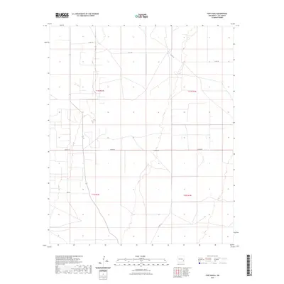
2023 Map of Fort Ranch
USGS Topo · Published 2023About this map
The High Plains of Lea County come into focus through the survey lines of Warren Rd and Co Rd 108. This area, defined by the Public Land Survey System boundaries of t14s r33e, t14s r34e, t15s r33e, and t15s r34e, represents the modern agricultural and ranching landscape of eastern New Mexico. The straight-line corridors of Jerry Ln and Co Rd 117 navigate a terrain marked by subtle depressions and the broad expanse of the Llano Estacado. This 2023 edition reflects a land organized for large-scale utility, where rural routes serve as the primary lifelines between isolated ranching outposts and grazing lands.
Find a feature on this map
8 named features on this map. Tap any name to fly to it.
Don’t see what you’re looking for? This feature index may not catch every label — zoom into the map to look around manually.
Map Details
Editions of this 2023 Fort Ranch Map
This is the sole edition of this map. No revisions or reprints were ever made.
Other maps of this area

1954 · Hobbs
USGS Topo · 1:250,000

1954 · Brownfield
USGS Topo · 1:250,000

1958 · Brownfield
USGS Topo · 1:250,000

1958 · Hobbs
USGS Topo · 1:250,000

1962 · Brownfield
USGS Topo · 1:250,000

1962 · Lovington
USGS Topo · 1:62,500

1962 · Buckeye
USGS Topo · 1:62,500

1970 · Alston Ranch
USGS Topo · 1:24,000

1970 · Hillburn City SW
USGS Topo · 1:24,000

1973 · Fort Ranch
USGS Topo · 1:24,000