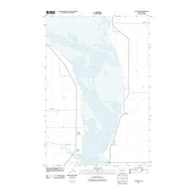
2011 Map of Fort Rice
USGS Topo · Published 2011About this map
Fort Rice serves as a focal point along the western banks of the Missouri River, marking a location of significant military and pioneer history in Morton County. The wide river valley is dominated by the extensive Kenel Flats, where the waterway splits into several channels and sandbars. On the western bluffs, the Fort Rice Military Cemetery and the adjacent Fort Rice Cemetery provide essential points of interest for genealogists and historians tracing the early settlement and defense of the Dakota Territory.
Find a feature on this map
19 named features on this map. Tap any name to fly to it.
Don’t see what you’re looking for? This feature index may not catch every label — zoom into the map to look around manually.
Map Details
Editions of this 2011 Fort Rice Map
This is the sole edition of this map. No revisions or reprints were ever made.
Other maps of this area

1907 · Bismarck
USGS Topo · 1:125,000

1954 · Bismarck
USGS Topo · 1:250,000

1958 · Bismarck
USGS Topo · 1:250,000

1962 · Sugarloaf Butte
USGS Topo · 1:24,000

1968 · Cannon Ball
USGS Topo · 1:24,000

1968 · Cannon Ball NW
USGS Topo · 1:24,000

1971 · Moffit SW
USGS Topo · 1:24,000

1971 · Huff
USGS Topo · 1:24,000

1971 · Fort Rice
USGS Topo · 1:24,000

1971 · Huff NE
USGS Topo · 1:24,000