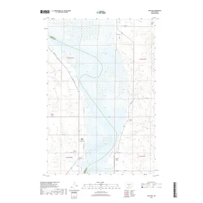
2017 Map of Fort Rice
USGS Topo · Published 2017About this map
Fort Rice anchors this stretch of the Missouri River valley where the borders of Morton and Emmons Counties meet. The landscape is dominated by the wide expanse of Lake Oahe, formed by the damming of the Missouri River. Historically significant sites are clustered on the western bank, including the Fort Rice Cem and nearby Saint Marys Cem, which offer vital data points for genealogists researching early settlement and military history in the Dakota Territory.
Find a feature on this map
36 named features on this map. Tap any name to fly to it.
Don’t see what you’re looking for? This feature index may not catch every label — zoom into the map to look around manually.
Map Details
Editions of this 2017 Fort Rice Map
This is the sole edition of this map. No revisions or reprints were ever made.
Other maps of this area

1907 · Bismarck
USGS Topo · 1:125,000

1954 · Bismarck
USGS Topo · 1:250,000

1958 · Bismarck
USGS Topo · 1:250,000

1962 · Sugarloaf Butte
USGS Topo · 1:24,000

1968 · Cannon Ball
USGS Topo · 1:24,000

1968 · Cannon Ball NW
USGS Topo · 1:24,000

1971 · Moffit SW
USGS Topo · 1:24,000

1971 · Huff
USGS Topo · 1:24,000

1971 · Fort Rice
USGS Topo · 1:24,000

1971 · Huff NE
USGS Topo · 1:24,000