
1971 Map of Fort Rice
USGS Topo · Published 1973About this map
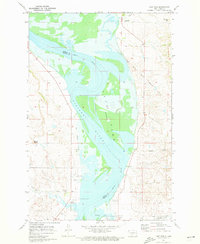
Fort Rice serves as the focal point of this 1970s landscape, situated along the western banks of the Missouri River where the Emmons and Morton County boundary meets the water. The map documents a period of significant hydrological transition, with the expansion of Lake Oahe at an elevation of 1608 feet, which flooded the river valley and altered the historical shoreline. Traces of the region's frontier past are evident in the Fort Rice Military Cem and the Fort Rice Historical Site, located within the Fort Rice Military Reservation Boundary. On the eastern shore, the small settlement of Livona and the Schiermeister Landing Strip sit near the jagged terrain of Devils Gulch. An Old Railroad Grade runs parallel to the western bank, marking a decommissioned transportation corridor that once followed the river's path through this Dakota territory.
Find a feature on this map
21 named features on this map. Tap any name to fly to it.
Don’t see what you’re looking for? This feature index may not catch every label — zoom into the map to look around manually.
Map Details
Editions of this 1971 Fort Rice Map
2 editions found
Other maps of this area

1907 · Bismarck
USGS Topo · 1:125,000

1954 · Bismarck
USGS Topo · 1:250,000

1958 · Bismarck
USGS Topo · 1:250,000

1962 · Sugarloaf Butte
USGS Topo · 1:24,000

1968 · Cannon Ball
USGS Topo · 1:24,000

1968 · Cannon Ball NW
USGS Topo · 1:24,000

1971 · Moffit SW
USGS Topo · 1:24,000

1971 · Huff
USGS Topo · 1:24,000

1971 · Huff NE
USGS Topo · 1:24,000

1971 · Moffit NW
USGS Topo · 1:24,000