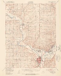
1947 Map of Fort Riley
USGS Topo · Published 1954About this map
The Republican River and Smoky Hill River converge at Junction City to form the Kansas River, anchoring a landscape dominated by the expansive Fort Riley Military Reservation. In the years following World War II, the area displays a complex mix of military infrastructure and established rural life. The reservation contains specialized training grounds such as the Vehicle Firing Range, Machine Gun Range, and the Sevenmile Impact Area, alongside established installations like Camp Forsyth and Marshall Air Force Base. Outside the military boundary, small farming communities and educational centers like Milford and Alida Sch persist. Numerous local burial grounds, including Barry Cem and Liberty Cem, provide valuable geographic markers for genealogists tracing families in the Riley and Geary county borderlands.
Find a feature on this map
87 named features on this map. Tap any name to fly to it.
Don’t see what you’re looking for? This feature index may not catch every label — zoom into the map to look around manually.
Map Details
Editions of this 1947 Fort Riley Map
2 editions found
Other maps of this area

1886 · Junction City
USGS Topo · 1:125,000

1889 · Junction City
USGS Topo · 1:125,000

1889 · Abilene
USGS Topo · 1:125,000

1889 · Parkerville
USGS Topo · 1:125,000

1891 · Clay Center
USGS Topo · 1:125,000

1894 · Junction City
USGS Topo · 1:125,000

1894 · Abilene
USGS Topo · 1:125,000

1894 · Parkerville
USGS Topo · 1:125,000

1947 · Manhattan
USGS Topo · 1:62,500

1947 · Fort Riley
USGS Topo · 1:62,500