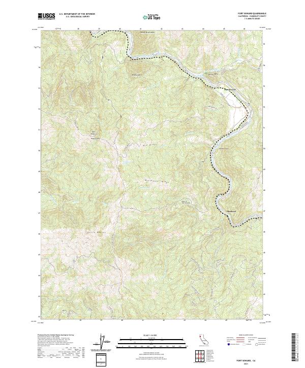
2021 Map of Fort Seward
USGS Topo · Published 2021About this map
Fort Seward sits at the northern end of this reach of the Eel River, where the landscape is defined by a series of steep ridges and isolated flats. The settlement at Steelhead serves as a southern anchor for the river-hugging Steelhead Rd, while the uplands are traversed by historical routes like the Dyerville Loop Rd and Fort Seward Rd. These roads navigate a complex series of summits, including the Tuttle Buttes and the aptly named Mail Ridge, showing the difficulty of travel through this part of Humboldt County.
Find a feature on this map
54 named features on this map. Tap any name to fly to it.
Don’t see what you’re looking for? This feature index may not catch every label — zoom into the map to look around manually.
Map Details
Editions of this 2021 Fort Seward Map
This is the sole edition of this map. No revisions or reprints were ever made.
Other maps of this area

1920 · Harris
USGS Topo · 1:62,500

1921 · Dyerville
USGS Topo · 1:62,500

1921 · Briceland
USGS Topo · 1:62,500

1949 · Blocksburg
USGS Topo · 1:62,500

1949 · Alderpoint
USGS Topo · 1:62,500

1949 · Garberville
USGS Topo · 1:62,500

1949 · Weott
USGS Topo · 1:62,500

1951 · Alderpoint
USGS Topo · 1:62,500

1951 · Weott
USGS Topo · 1:62,500

1951 · Garberville
USGS Topo · 1:62,500