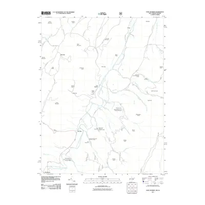
2011 Map of Fort Seybert
USGS Topo · Published 2011About this map
The South Fork South Branch Potomac River carves a deep valley through this West Virginia landscape, anchoring the historic settlement of Fort Seybert. This 2011 survey documents a community defined by its proximity to the river and the gaps in the surrounding ridges, such as Kane Gap and Dean Gap. Genealogists will find significant value in the documentation of local burial grounds, including the Fairview Bethel Cemetery, Dice Cemetery, and Hinkle Cemetery, which mark family and community history near the riverbanks. The map also records a modern era of water management, evidenced by several flood control structures like South Fork Structure Number 21 Dam and Dam Number 12 South Fork Structure Number 12 Dam. Small hamlets such as Oak Flat, Brandywine, and Sweedlin are linked by winding roads like S Fork Rd, reflecting the enduring settlement patterns in Pendleton County.
Find a feature on this map
65 named features on this map. Tap any name to fly to it.
Don’t see what you’re looking for? This feature index may not catch every label — zoom into the map to look around manually.
Map Details
Editions of this 2011 Fort Seybert Map
This is the sole edition of this map. No revisions or reprints were ever made.
Other maps of this area

1892 · Franklin
USGS Topo · 1:125,000

1896 · Franklin
USGS Topo · 1:125,000

1920 · Petersburg
USGS Topo · 1:48,000

1920 · Onego
USGS Topo · 1:62,500

1921 · Petersburg
USGS Topo · 1:48,000

1921 · Onego
USGS Topo · 1:48,000

1922 · Onego
USGS Topo · 1:62,500

1922 · Fort Seybert
USGS Topo · 1:48,000

1922 · Petersburg
USGS Topo · 1:62,500

1922 · Circleville
USGS Topo · 1:62,500