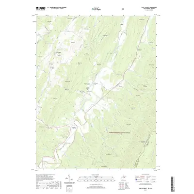
2019 Map of Fort Seybert
USGS Topo · Published 2019About this map
Fort Seybert and the surrounding Sweedlin Valley are defined by the winding course of the South Fork South Branch Potomac River. This area of Pendleton County retains a rural, mountain character where early settlement patterns are still visible through family and community landmarks. Local history and genealogy are anchored by several burial grounds, including Fairview Bethel Cem, Dice Cem, and Hinkle Cem, while the Fort Seybert Bridge serves as a key crossing point for the river.
Find a feature on this map
91 named features on this map. Tap any name to fly to it.
Don’t see what you’re looking for? This feature index may not catch every label — zoom into the map to look around manually.
Map Details
Editions of this 2019 Fort Seybert Map
This is the sole edition of this map. No revisions or reprints were ever made.
Other maps of this area

1892 · Franklin
USGS Topo · 1:125,000

1896 · Franklin
USGS Topo · 1:125,000

1920 · Petersburg
USGS Topo · 1:48,000

1920 · Onego
USGS Topo · 1:62,500

1921 · Petersburg
USGS Topo · 1:48,000

1921 · Onego
USGS Topo · 1:48,000

1922 · Onego
USGS Topo · 1:62,500

1922 · Fort Seybert
USGS Topo · 1:48,000

1922 · Petersburg
USGS Topo · 1:62,500

1922 · Circleville
USGS Topo · 1:62,500