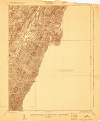
1922 Map of Fort Seybert
USGS Topo · Published 1922About this map
Fort Seybert and the surrounding mountain ridges of Pendleton County are documented in this 1920s topography by E.I. Ireland. The settlement patterns of the era are clearly visible, with numerous country schools and churches dotting the landscape, including Egypt School and New Bethel Church. This West Virginia landscape is defined by the South Fork Potomac River and the parallel ridges of Mill Run Mountain and Hog Ridge. The map reveals a high density of rural education sites like Dale Hill School and Locust Grove School, serving the small valley communities situated along Rough Run and Halls Creek. These labels provide a window into the social geography of the region before modern consolidation changed the local infrastructure.
Find a feature on this map
47 named features on this map. Tap any name to fly to it.
Don’t see what you’re looking for? This feature index may not catch every label — zoom into the map to look around manually.
Map Details
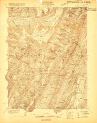
Editions of this 1922 Fort Seybert Map
2 editions found

Other maps of this area

1892 · Franklin
USGS Topo · 1:125,000

1892 · Woodstock
USGS Topo · 1:125,000

1892 · Harrisonburg
USGS Topo · 1:125,000

1894 · Staunton
USGS Topo · 1:125,000

1896 · Franklin
USGS Topo · 1:125,000

1920 · Petersburg
USGS Topo · 1:48,000
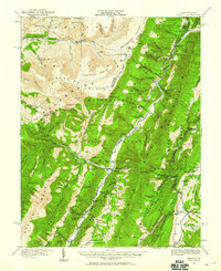
1920 · Onego
USGS Topo · 1:62,500

1921 · Orkney Springs
USGS Topo · 1:48,000

1921 · Petersburg
USGS Topo · 1:48,000
1921 · Onego
USGS Topo · 1:48,000