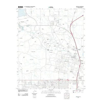
2012 Map of Fort Sill
USGS Topo · Published 2012About this map
Fort Sill serves as the dominant anchor of this Comanche County landscape, where the intersection of military operations and regional history is clearly visible. The map details the installation's complex geography, from the Henry Post Army Airfield to tactical landmarks such as Grenade Crossing and Corral Hill. Notable for genealogists and local historians are the designated burial sites, including the Ft Sill Post Cem, Indian Agency Cem, and Highland Cem. The terrain is characterized by a series of prominent elevations and ridges like Medicine Bluffs, Signal Mtn, and Mission Ridge, which overlook the winding course of Medicine Cr. To the south, residential expansion is evident in Artillery Village and Sneed Acres, while the northern reaches provide a view toward Lake Lawtonka and the conservation lands of the Martha Songbird Wildlife Management Area.
Find a feature on this map
148 named features on this map. Tap any name to fly to it.
Don’t see what you’re looking for? This feature index may not catch every label — zoom into the map to look around manually.
Map Details
Editions of this 2012 Fort Sill Map
This is the sole edition of this map. No revisions or reprints were ever made.
Other maps of this area

1937 · Cache
USGS Topo · 1:48,000

1942 · Cache
USGS Topo · 1:62,500

1946 · Lawton
USGS Topo · 1:62,500

1949 · Mount Scott
USGS Topo · 1:24,000

1949 · Arbuckle Hill
USGS Topo · 1:24,000

1949 · Elgin
USGS Topo · 1:24,000

1949 · Fort Sill
USGS Topo · 1:24,000

1950 · Saddle Mountain
USGS Topo · 1:62,500

1955 · Lawton
USGS Topo · 1:250,000

1956 · Ninemile Creek
USGS Topo · 1:24,000