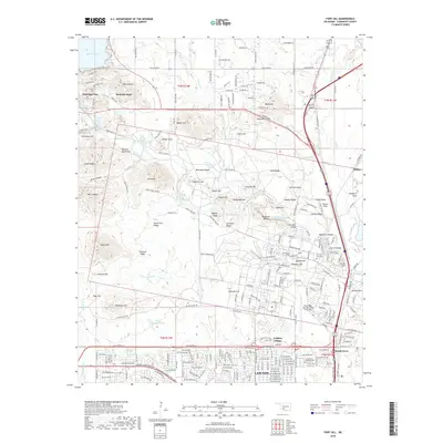
2018 Map of Fort Sill
USGS Topo · Published 2018About this map
Medicine Park sits at the northern edge of this terrain, where the Wichita Mountains meet the waters of Lake Lawtonka. This landscape is defined by the extensive military geography of Fort Sill, featuring the Henry Post Army Airfield and the Fort Sill Post Cem. The map illustrates a transition from the structured residential blocks of Lawton and Artillery Village in the south to a complex network of ridges and tactical landmarks like Medicine Bluffs, Artillery Ridge, and Signal Mtn.
Find a feature on this map
100 named features on this map. Tap any name to fly to it.
Don’t see what you’re looking for? This feature index may not catch every label — zoom into the map to look around manually.
Map Details
Editions of this 2018 Fort Sill Map
This is the sole edition of this map. No revisions or reprints were ever made.
Other maps of this area

1937 · Cache
USGS Topo · 1:48,000

1942 · Cache
USGS Topo · 1:62,500

1946 · Lawton
USGS Topo · 1:62,500

1949 · Mount Scott
USGS Topo · 1:24,000

1949 · Arbuckle Hill
USGS Topo · 1:24,000

1949 · Elgin
USGS Topo · 1:24,000

1949 · Fort Sill
USGS Topo · 1:24,000

1950 · Saddle Mountain
USGS Topo · 1:62,500

1955 · Lawton
USGS Topo · 1:250,000

1956 · Ninemile Creek
USGS Topo · 1:24,000