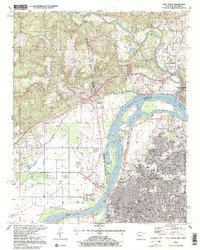
1997 Map of Fort Smith
USGS Topo · Published 1999About this map
The confluence of the Arkansas River and Poteau River anchors this borderland survey, where the urban grid of Fort Smith meets the expansive agricultural lands of Moffett Bottom across the state line. The landscape reflects a dense history of settlement and civic infrastructure, characterized by numerous neighborhood schools such as North Side High School and Kimmons Junior High School. Transport networks are vital here, with the Kansas City Southern RR cutting through the terrain and major thoroughfares like Rogers Avenue and Midland Avenue defining the city's growth.
Find a feature on this map
67 named features on this map. Tap any name to fly to it.
Don’t see what you’re looking for? This feature index may not catch every label — zoom into the map to look around manually.
Map Details
Editions of this 1997 Fort Smith Map
2 editions found
Other maps of this area

1879 · Fort Smith
USGS Topo · 1:62,500

1887 · Van Buren
USGS Topo · 1:62,500

1890 · Fort Smith
USGS Topo · 1:125,000

1898 · Winslow #3
USGS Topo · 1:62,500

1898 · Tahlequah
USGS Topo · 1:125,000

1898 · Winslow
USGS Topo · 1:125,000

1900 · Sallisaw
USGS Topo · 1:125,000

1901 · Winslow
USGS Topo · 1:125,000

1901 · Tahlequah
USGS Topo · 1:125,000

1905 · Tahlequah
USGS Topo · 1:125,000