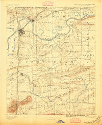
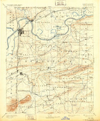
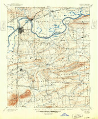
1890 Map of Fort Smith
USGS Topo · Published 1896About this map
Fort Smith and Van Buren serve as the primary hubs on this late 19th-century survey, situated at a vital convergence of the Arkansas River and several emerging rail lines. The map documents a critical period of western expansion where the boundaries of Sebastian and Crawford counties meet the Indian Territory border, featuring the Cherokee Nation and Choctaw Nation to the west. This frontier landscape is characterized by a series of prominent ridges, including Backbone Mountain and the White Oak Mountains, which dictated the early movement of settlers and the placement of remote outposts.
Find a feature on this map
110 named features on this map. Tap any name to fly to it.
Don’t see what you’re looking for? This feature index may not catch every label — zoom into the map to look around manually.
Map Details
Editions of this 1890 Fort Smith Map
7 editions found

Other maps of this area

1879 · Poteau Mountain
USGS Topo · 1:62,500

1879 · Cravens
USGS Topo · 1:62,500

1879 · Fort Smith
USGS Topo · 1:62,500

1887 · Poteau Mountain #1
USGS Topo · 1:62,500

1887 · Van Buren
USGS Topo · 1:62,500

1887 · Mount Ida #2
USGS Topo · 1:62,500

1887 · Magazine Mountain #2
USGS Topo · 1:62,500

1887 · Magazine Mountain #3
USGS Topo · 1:62,500

1887 · Watalula
USGS Topo · 1:62,500

1887 · Magazine Mountain
USGS Topo · 1:62,500