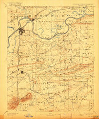
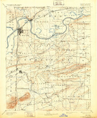
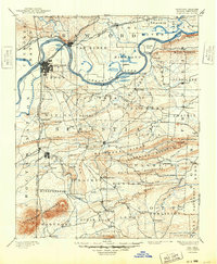
1890 Map of Fort Smith
USGS Topo · Published 1916About this map
The Fort Smith region at the close of the nineteenth century is defined by its position on the border between Arkansas and the Cherokee Nation in the Indian Territory. This survey captures a landscape transitioning from river-based transport to a complex rail network, featuring the Kansas and Arkansas Valley Railroad and the St. Louis and San Francisco Railroad converging at the Arkansas River.
Find a feature on this map
104 named features on this map. Tap any name to fly to it.
Don’t see what you’re looking for? This feature index may not catch every label — zoom into the map to look around manually.
Map Details
Editions of this 1890 Fort Smith Map
7 editions found

Other maps of this area

1879 · Poteau Mountain
USGS Topo · 1:62,500

1879 · Cravens
USGS Topo · 1:62,500

1879 · Fort Smith
USGS Topo · 1:62,500

1887 · Poteau Mountain #1
USGS Topo · 1:62,500

1887 · Van Buren
USGS Topo · 1:62,500

1887 · Mount Ida #2
USGS Topo · 1:62,500

1887 · Magazine Mountain #2
USGS Topo · 1:62,500

1887 · Magazine Mountain #3
USGS Topo · 1:62,500

1887 · Watalula
USGS Topo · 1:62,500

1887 · Magazine Mountain
USGS Topo · 1:62,500