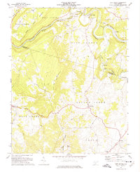
1971 Map of Fort Spring
USGS Topo · Published 1975About this map
The Greenbrier River and the Chesapeake and Ohio railroad corridor dominate this early 1970s landscape, illustrating a rugged transition between the industrial mining operations of Snowflake and Frazier and the agricultural karst terrain of the Irish Corner. The presence of Mines, a Quarry, and industrial infrastructure like a Conveyer near Fort Spring Mountain highlights the region's extraction history, while the southern portion of the map reveals a more pastoral character. Second Creek meanders through the landscape, passing a Covered Bridge and historical milling sites such as Hokes Mill and Nickells Mill. The settlement patterns of Sinks Grove and Pickaway reflect established rural communities anchored by local institutions like James Memorial Ch and Mt Zion Ch, providing a detailed view of Monroe County's social and industrial fabric before modern developments.
Find a feature on this map
47 named features on this map. Tap any name to fly to it.
Don’t see what you’re looking for? This feature index may not catch every label — zoom into the map to look around manually.
Map Details
Editions of this 1971 Fort Spring Map
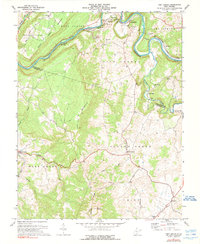
2 editions found
Other maps of this area

1887 · Hinton
USGS Topo · 1:125,000

1887 · Lewisburg
USGS Topo · 1:125,000

1891 · Lewisburg
USGS Topo · 1:125,000

1892 · Hinton
USGS Topo · 1:125,000

1921 · Alderson
USGS Topo · 1:48,000

1921 · White Sulphur Springs
USGS Topo · 1:48,000

1921 · Clintonville
USGS Topo · 1:48,000

1921 · Ronceverte
USGS Topo · 1:48,000

1923 · Clintonville
USGS Topo · 1:62,500

1923 · White Sulphur Springs
USGS Topo · 1:62,500